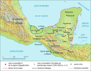
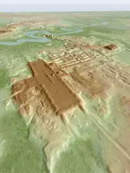
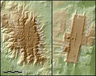
AGUADA FÉNIX, site archéologique
Bibliographie
M. Canuto et al., « Ancient lowland Maya complexity as revealed by airborne laser scanning of northern Guatemala », in Science, vol. 361, n° 6409, 2018 (doi : 10.1126/science.aau0137)
A. F. Chase et al., « Airborne LiDAR, archaeology, and the ancient Maya landscape at Caracol, Belize », in Journal of Archaeological Science,vol. 38, n° 2, 2011 (doi : 10.1016/j.jas.2010.09.018)
C. T. Fisher et al., « Identifying ancient settlement patterns through LiDAR in the Mosquitia region of Honduras », in Plos One, 25 août 2016 (doi : 10.1371/journal.pone.0159890)
D. A. Freidel, A. F. Chase, A. S. Dowd & J. Murdock éd., Maya E Groups. Calendars, Astronomy, and Urbanism in the Early Lowlands, University Press of Florida, Gainesville, 2017
R. D. Hansen et al., « LiDAR analyses in the contiguous Mirador-Calakmul karst basin, Guatemala: an introduction to new perspectives on regional early Maya socioeconomic and political organization », in Ancient Mesoamerica, 2022 (doi : 10.1017/S0956536122000244)
T. Inomata et al., « Monumental architecture at Aguada Fénix and the rise of Maya civilization », in Nature, n° 582, 2020 (doi : 10.1038/s41586-020-2343-4)
I. Sprajc, T. Inomata& A. F. Aveni, « Origins of Mesoamerican astronomy and calendar: evidence from the Olmec and Maya regions », in Science Advances, vol. 9, n° 1, 2023 doi : 10.1126/sciadv.abq7675)
T. W. Stanton et al., « ‘Structure’ density, area, and volume as complementary tools to understand Maya settlement: an analysis of lidar data along the great road between Coba and Yaxuna », in Journal of Archaeological Science: Reports, vol. 29, 2019.
La suite de cet article est accessible aux abonnés
- Des contenus variés, complets et fiables
- Accessible sur tous les écrans
- Pas de publicité
Déjà abonné ? Se connecter
Écrit par
- Éric TALADOIRE : professeur émérite des Universités
Classification
Médias


